Nana Akosua's sketch showed the odum tree, the stream and a line marked "Darko farm". It was a precious piece of family memory. But when Adwoa held it next to the map on her phone, she realised it didn't answer a simple question.
Where, exactly, does the family's land end?
"The old people used to say from the tree to the stream," her father said. "But the stream has moved over the years. And the neighbours have their own ideas."
The Mensahs are a fictional family. Their story follows common situations that many Ghanaian families will recognise.
Why boundaries matter
A boundary is where your family's land ends and someone else's begins. When a boundary is only remembered, not properly recorded, uncertainty can grow over time. Landmarks can change, and people's recollections of a boundary can differ. A tree is cut down, a stream changes course, or an old marker is lost.
A clear, professionally surveyed boundary helps a family know exactly what it holds. It can reduce misunderstandings with neighbours, and it gives anyone the family deals with, such as a tenant, a buyer or an official office, a clearer picture of the land.
Sketches, phone maps and proper plans
Families often have more than one kind of "map". It helps to understand the difference.
A hand-drawn sketch records what someone remembers: landmarks, neighbours, rough shapes. It is useful for conversation and memory, but it is not drawn to accurate measurements.
A phone map or GPS points can show roughly where the land is. They are a good way to help a family talk about the land, but phone locations can be inaccurate, and anyone can mark a point. A phone map is not a survey.
A site plan prepared by a licensed surveyor is a professional drawing showing the land's position, shape, size and boundary points, using accurate measurements and coordinates.
An approved plan is the version used in official processes. For deed registration, for example, the Lands Commission requires an approved site plan signed by the licensed surveyor and by the Director of the Survey and Mapping Division, with details that match the document being registered. Applications for an official search of land records also require site plans showing grid values or coordinates.
What surveying involves
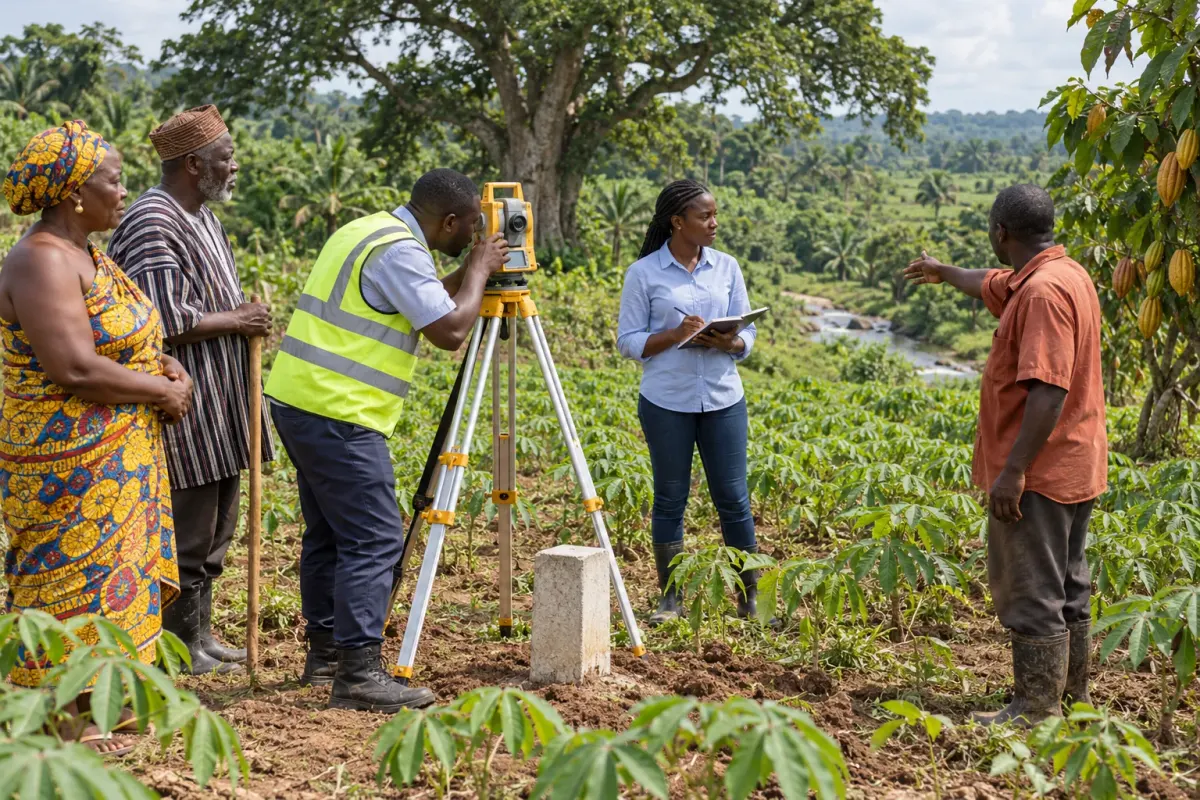
Surveying means measuring the land accurately and recording its boundaries. In general, a surveyor will:
- Meet the family and look at any existing documents and sketches.
- Walk the land with the family, noting the boundary points and landmarks people identify.
- Take accurate measurements and coordinates.
- Place boundary markers, often concrete pillars, where appropriate.
- Prepare a site plan and guide the family on what is needed for any official approval.
Finding the right professional
In Ghana, land surveying for official purposes is carried out by licensed surveyors, and the Lands Commission licenses private surveyors. Families should check that the person they engage is properly licensed. The Lands Commission's Survey and Mapping Division is the right place to ask if you are unsure.
Before work begins, it is sensible for the family to:
- Agree within the family, with those who have authority, that the survey should go ahead.
- Ask for a clear written quotation and what it includes.
- Ask what the family needs to provide, such as documents, people present on the day, and access to the land.
- Keep every receipt for payments made.
Be cautious of anyone who offers a "site plan" without visiting the land, or who promises shortcuts.
On the day: neighbours and elders
Surveys go best when elders who know the land and neighbours who share its boundaries are present, so everyone sees where the markers are placed.
When the surveyor came to the Mensah farm, Wofa Kwabena and Nana Akosua walked the boundary with him. Mr Darko, whose family farms next door, was there too. At the corner near the stream, he disagreed about where the line should run.
The surveyor recorded what each side said and did not finalise that corner. The following week, the elders of both families met calmly with the surveyor, agreed where the line ran, and the plan was completed.
This fictional example illustrates one peaceful resolution. Not every boundary dispute can be settled the same way; some need legal advice, mediation or the involvement of the appropriate authority. Whatever the situation, disputed boundaries should never be settled by moving markers, clearing land or confronting neighbours. If a boundary is disputed, or someone else claims the land, let the adults with authority seek proper advice. Young people should never be put in the middle.
How you can help
- Share your phone map as a helpful starting point, while being clear that it is not a survey.
- Help prepare the documents and sketches the surveyor may want to see.
- Take notes on the day, if your family wants you to, of who attended and what was agreed.
- Keep copies of the plan and receipts safely with the family's other papers.
Questions to raise at home
- "Has our land ever been surveyed by a licensed surveyor?"
- "Do our neighbours agree with us about where our boundaries are?"
What comes next
With the plan completed, Kofi asked the next question: "Now, how do we make it official?"
In the next article, Making It Official, we look at why appropriate registration matters, and how families can find the right route for their land.
Sources (checked 24 October 2026)
- Lands Commission: Deed Registration
- Lands Commission: Official/Administrative Search
- Lands Commission: Survey and Mapping Division
- Lands Commission: Lands Commission awards licences to 50 private surveyors
Requirements can change. Always check the Lands Commission's current guidance before acting.